
TEMPLE, Texas — You may have seen the symbols for high and low pressure often, but what exactly do they represent? Keep reading to find out as Meteorologist Avaionia Smith breaks down the difference between high and low pressure in this Weather Impact 101.
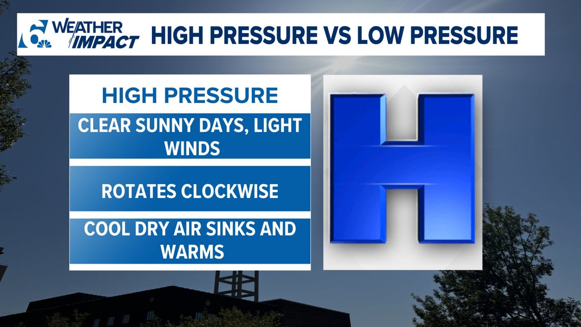
Let’s start on a high note! High pressure is represented by a blue capital letter H. It is normally associated with clear sunny days and maybe a light breeze present. High pressure happens when cool and dry air sinks then warms up. Think about when you’re cooking and you close the lid on a pot, trapping the heat inside. The same can be felt of us at the surface, so typically when high pressure is present, we will also have warmer days.

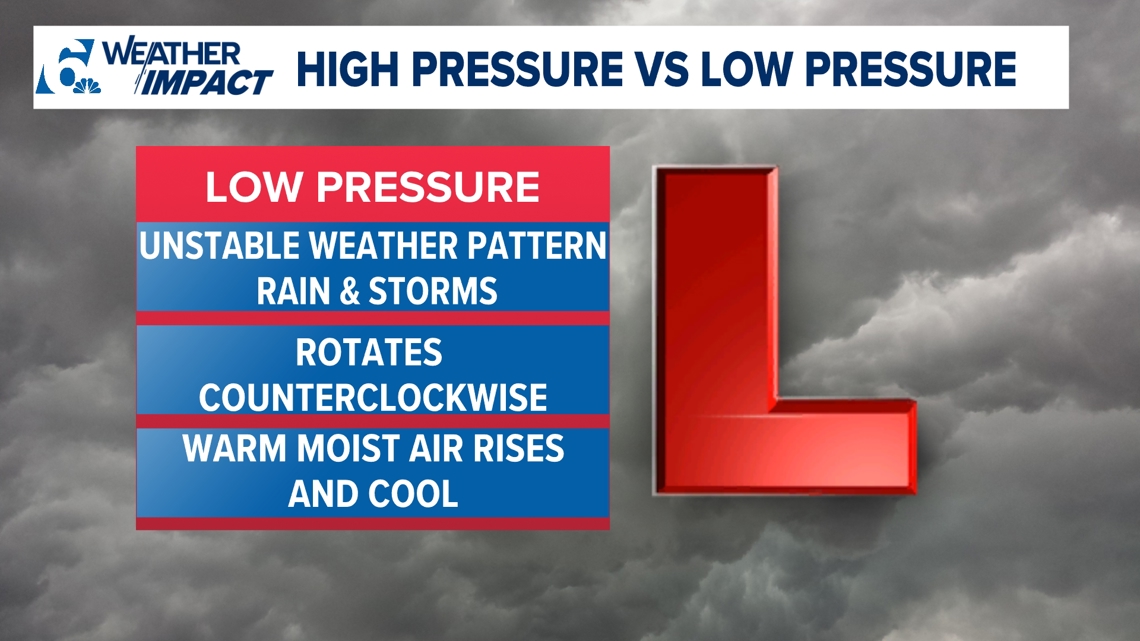
Now, let's go low! Low pressure happens when warm, moist air rises and cools. Plenty of moisture rises, so that's why you will see cloud formation and the chance for rain and storms in the forecast. Low pressure brings an unstable weather pattern and it rotates counterclockwise in the Northern Hemisphere.

High and low pressure are also the drivers of calm or gusty winds. Air pressure is always in a constant battle to remain at equal pressure (balanced). When weak high pressure is met with weak low pressure they produce weak winds. Stronger winds are produced when a strong high and low pressure met, that's when wind could reach up to 35mph or greater. The difference of pressure could also create different blocking patterns in the upper levels.
More Weather Impact 101 from 6 News: