

TEMPLE, Texas — HOURLY FORECAST: See what the weather will be like by the hour
LIVE INTERACTIVE RADAR: Track your forecast in real-time
Text weather pictures and videos to 254-777-6000. You can also download the 6 News App in your App Store to get live radar, the latest forecast and send us pictures and videos through the Near Me feature in the lower right corner.
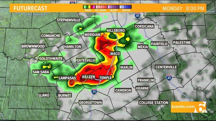
According to the 6 News Weather Team, there is a risk for severe weather on Monday in Central Texas as high temps and strong southerly winds are creating a perfect environment for storms to develop.
Throughout Monday evening, Central Texans can expect cloud cover that attributes to hot, humid conditions leading up to the storms.
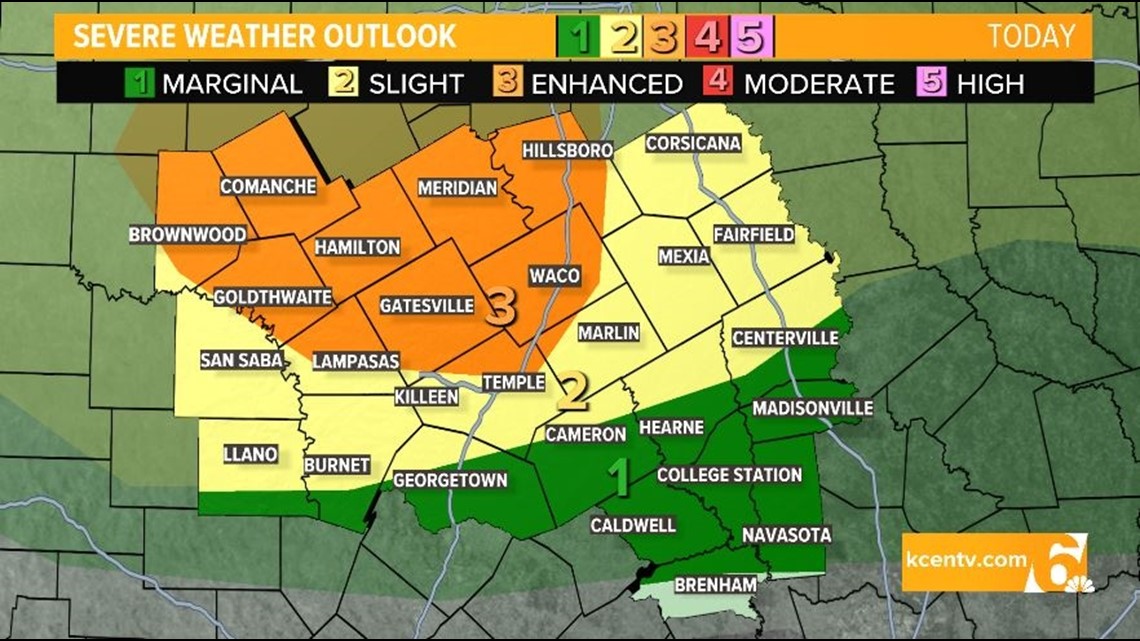
The 6 News Weather Team says that areas north of Temple, including Waco, Hillsboro and Gatesville are all at a Level 3 Enhanced risk for severe storms.
Areas east and west of Temple, such as Killeen, Marlin and Mexia are all at a reduced Level 2 Slight risk for severe weather.
The severe weather could bring high-speed winds, hail, heavy rain and even tornadoes.
Be sure to remain weather aware and look out for any alerts from the 6 News App

Tuesday: 20% chance for showers and partly cloudy with highs near 99°. Winds S at 15+ mph.
Wednesday: 20% chance for showers and mostly sunny with highs near 99°. Winds SSE at 10-15+ mph.
Thursday: Mostly sunny with highs near 101°. Winds S at 10-15+ mph.
Friday: Mostly sunny with highs near 104°. Winds SSW at 10-15 mph.
Saturday: Partly cloudy with highs near 103°. Winds SSW at 5-10 mph.
Sunday: Mostly sunny with highs near 104°. Winds S at 10-15 mph.