


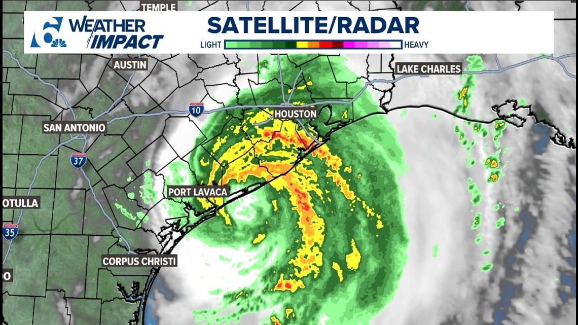
Hurricane Beryl strengthened back into a Hurricane late last night, and is currently making landfall as of 4:00 AM as a Category 1 Hurricane with winds at 80 mph. The Houston metro and coastline to the Southeast of Houston are being drenched with torrential rainfall. Peak storm surge was 3-5 feet this morning.
PICTURE FROM WHEN BERYL MADE LANDFALL:

A FEW REPORTS:
-A 22.5 foot wave was picked up by a buoy within the area where Beryl was spinning this morning
-An unconfirmed wind gust of 93 mph near Matagorda was picked up by a storm chaser
-Tornado warnings were popping up within rain bands west of Houston in the 4:00 AM hour
-More Tornado Warnings were popping up east of Houston in the 8:00 AM hour. Ongoing flooding and high wind reports from all around the Houston and Galveston areas in the 8:00 AM hour.
WHAT TO EXPECT NEXT:
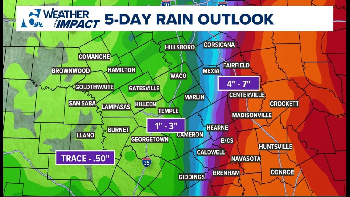
Bryan College Station and the Brazos Valley started to receive outer bands from Beryl in the 6:00 AM hour; moderate showers continue mid morning.
Areas along I-35 may receive 1-2 inches of rain at most through this afternoon; our far eastern counties may have pockets of 3+ inch amounts causing Flash Flooding. Areas West of I-35 are expected to receive no activity to an inch of rain. Because Beryl shifted even further east overnight last night, impacts are expected to be less than projected for CenTex.
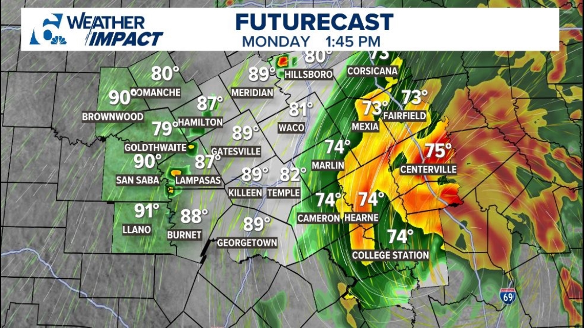
Here is what one model is showing for after lunch today:

Here are potential rain totals this week, mostly because of Beryl:

Stay safe, Central Texas! Turn around, Don't Drown