
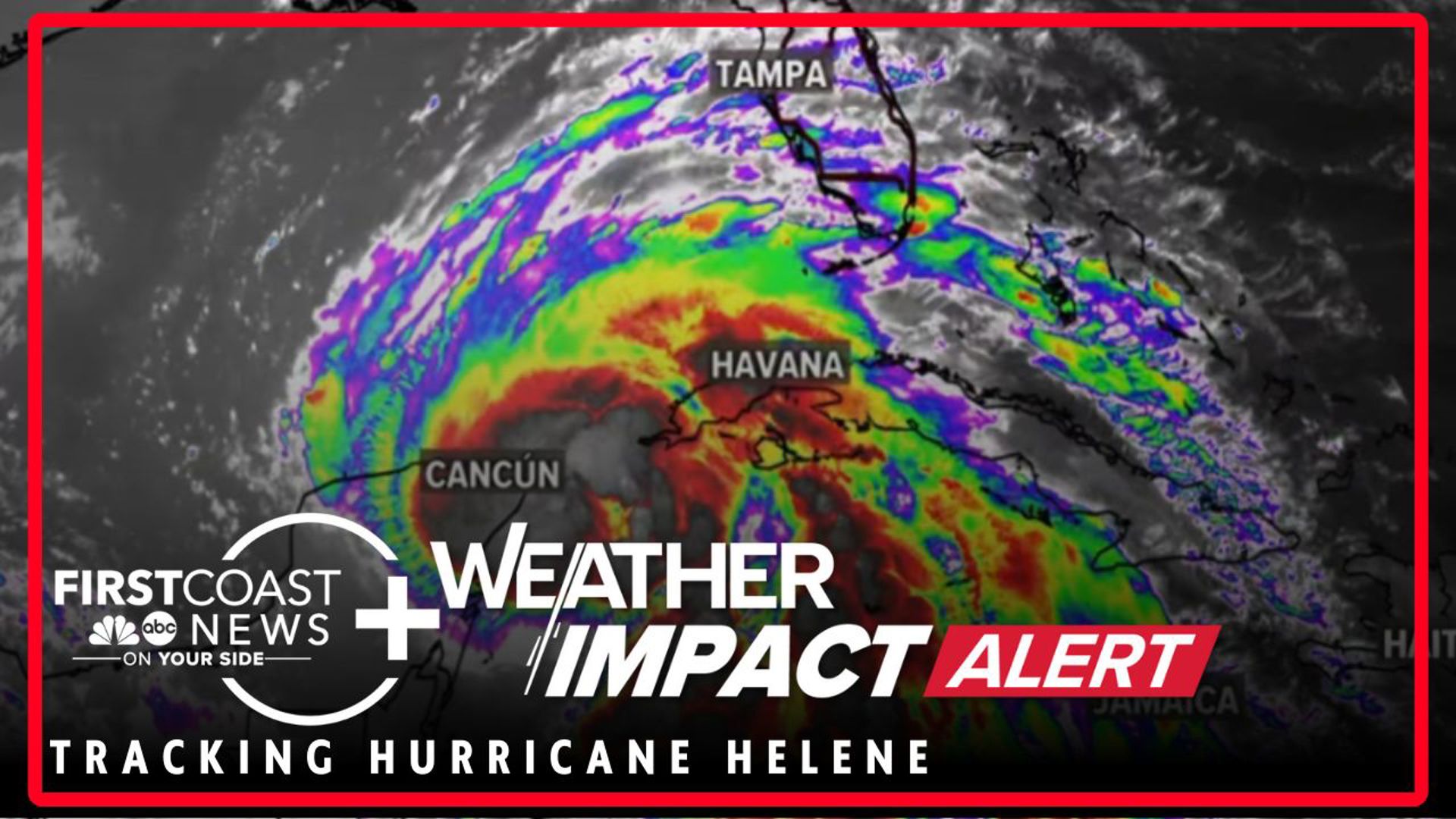
JACKSONVILLE, Fla. — Hurricane Helene continues to strengthen as it makes its way toward Florida's Big Bend region.
Movement and wind speed
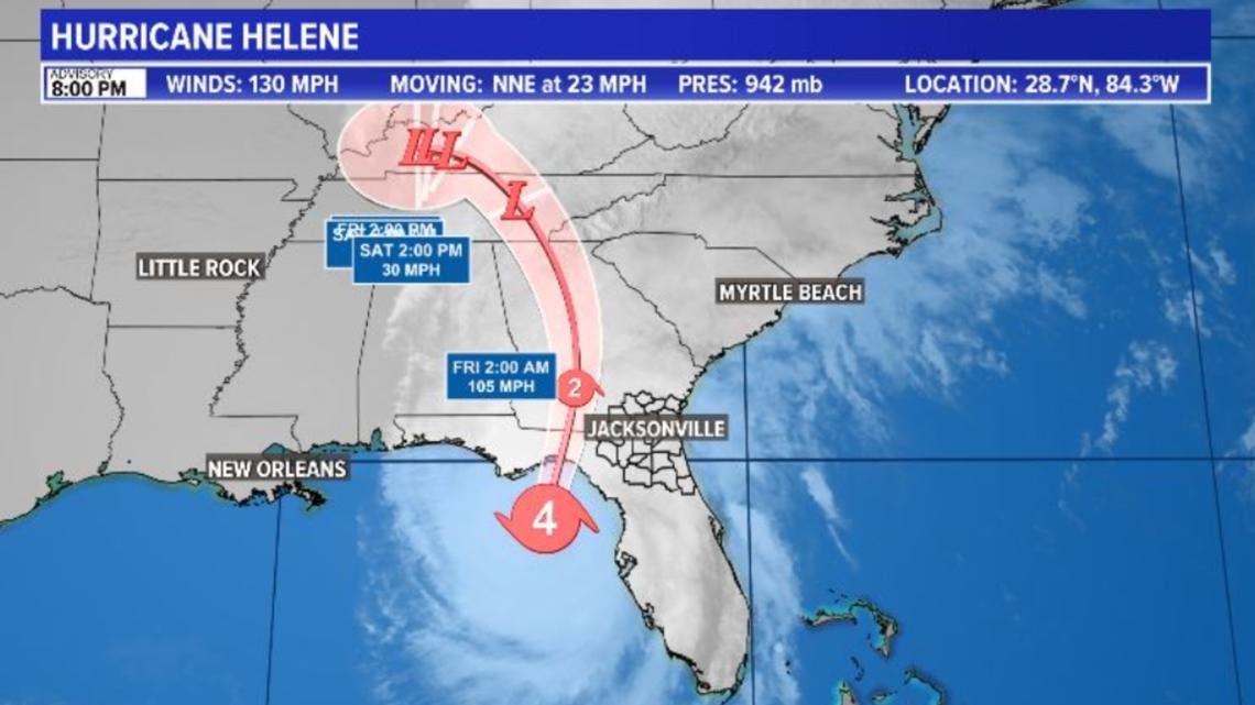
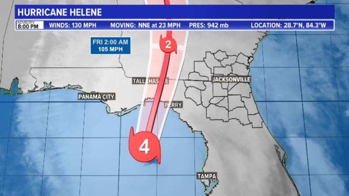
Helene is moving north-northeast at 23 mph and making a beeline toward Florida's Big Bend. It currently is showing winds of 130 mph as the air pressure continues to drop down now to 947mb.
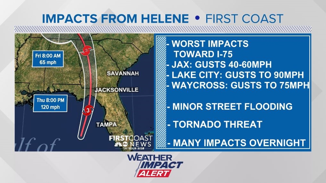
The storm is currently situated about 120 miles west of Tampa and about 145 miles south of Tallahassee.
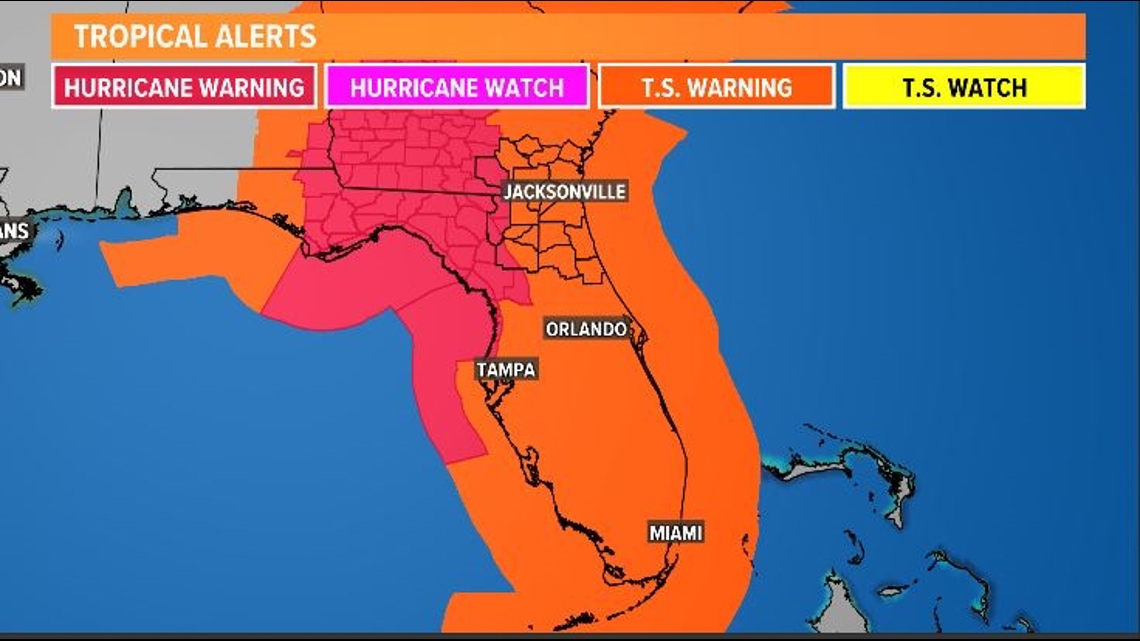
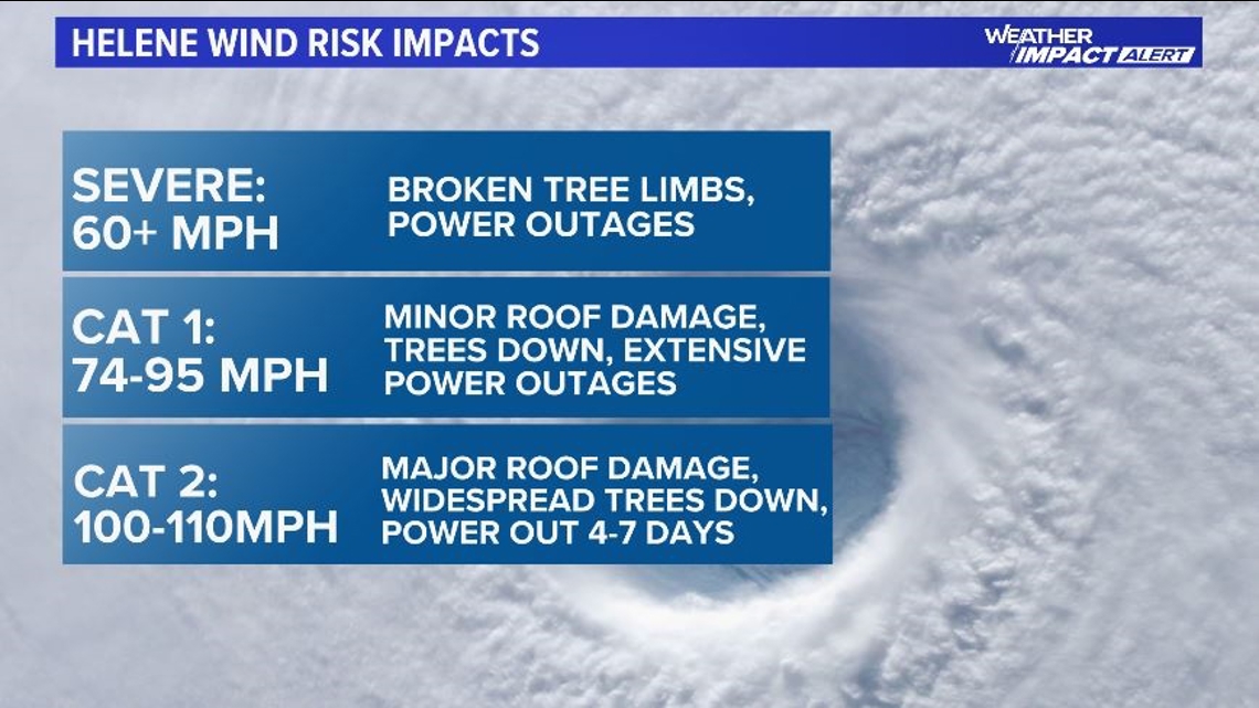
Hurricane Warnings have been issued for Columbia County, which would include Lake City in our area. Hurricane warnings then extend all the way to the coast for essentially all counties west of I-75 to Florida's Big Bend area on the Gulf Coast.
Watches and warnings
Tropical Storm warnings are in place for all other local counties across the First Coast and Southeast Georgia.
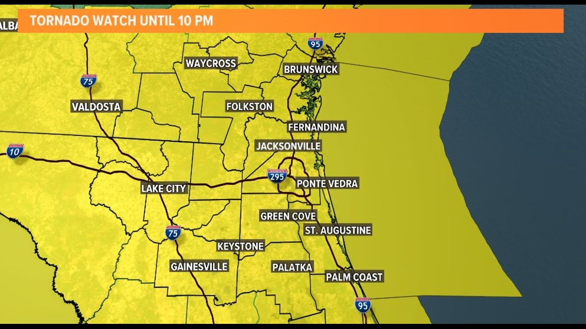
A Tornado Watch is in effect for our entire area until 10 p.m.

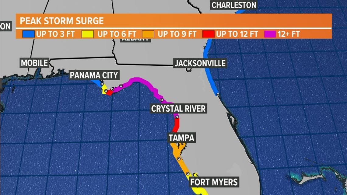
Helene is forecasted to make landfall as a major Category 3 hurricane in Apalachee Bay Thursday evening between 9 and 11 p.m.
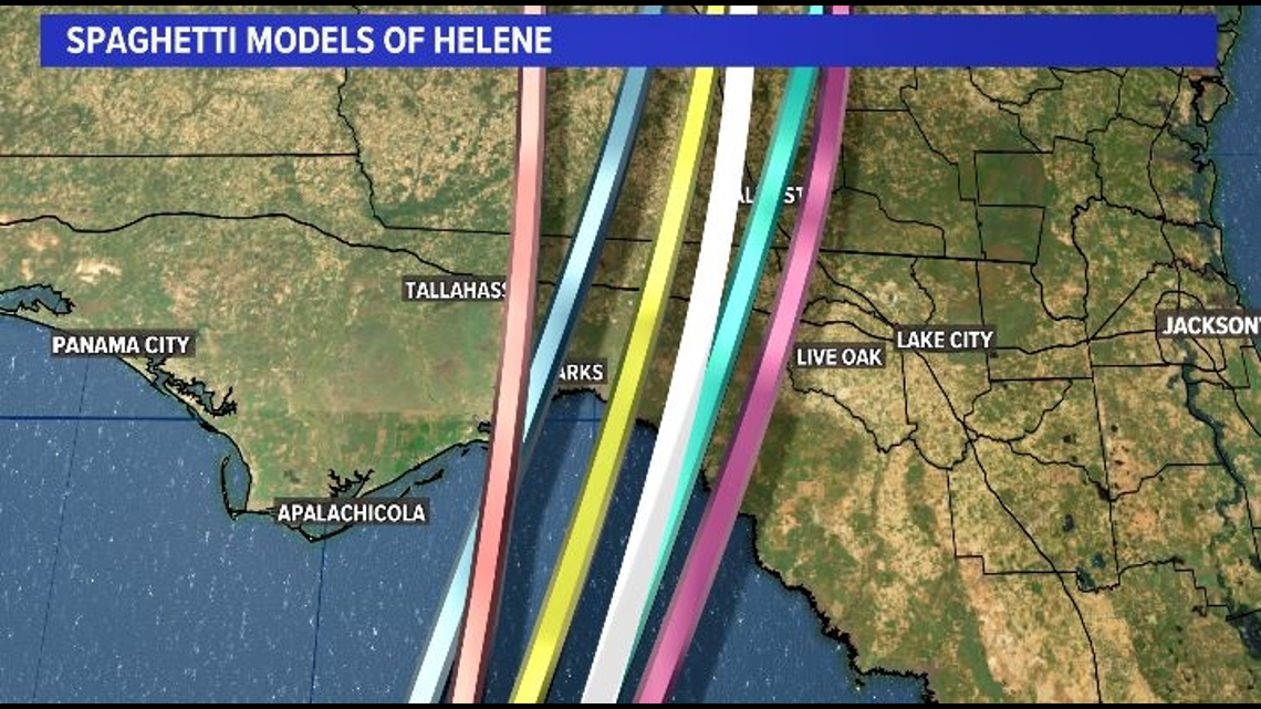
Helene Models


The First Coast News Most Accurate Weather Team issued a Weather Impact Alert Day for Thursday and into Friday.
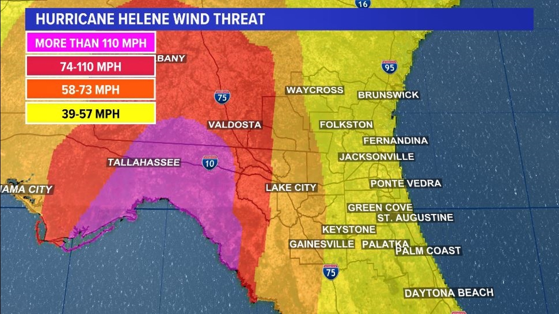
The Jacksonville metro and I-95 corridor will experience wind gusts of 40-60 mph throughout Thursday evening, however Lake City and areas along and near I-75 could see hurricane force winds of 75-90 mph.


For radar, spaghetti models, forecast cone and more, click here.
The eyewall (where damage is exponentially worse), should make landfall over 100 miles to our west.
The eastern eyewall looks to be very close to Lake City after sunset Thursday.